Vectorworks 2025 introduces powerful tools for landscape architecture and site design workflows.
The new Curbs, Edging, and Borders tool brings exciting possibilities to your design space, and updates to the Hardscape and Landscape Area tools provide new convenient data fields for the integration of sustainability data. The Survey Point tool streamlines establishing geographic base points in your projects.
Let’s see what each feature does.
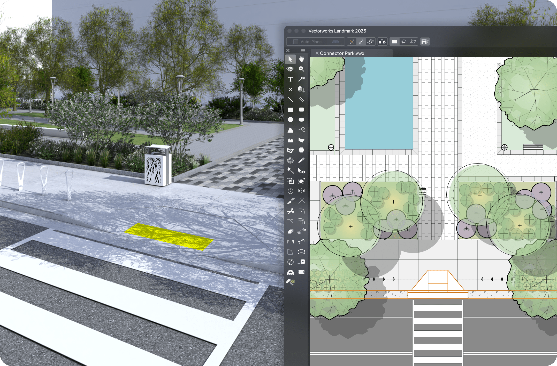
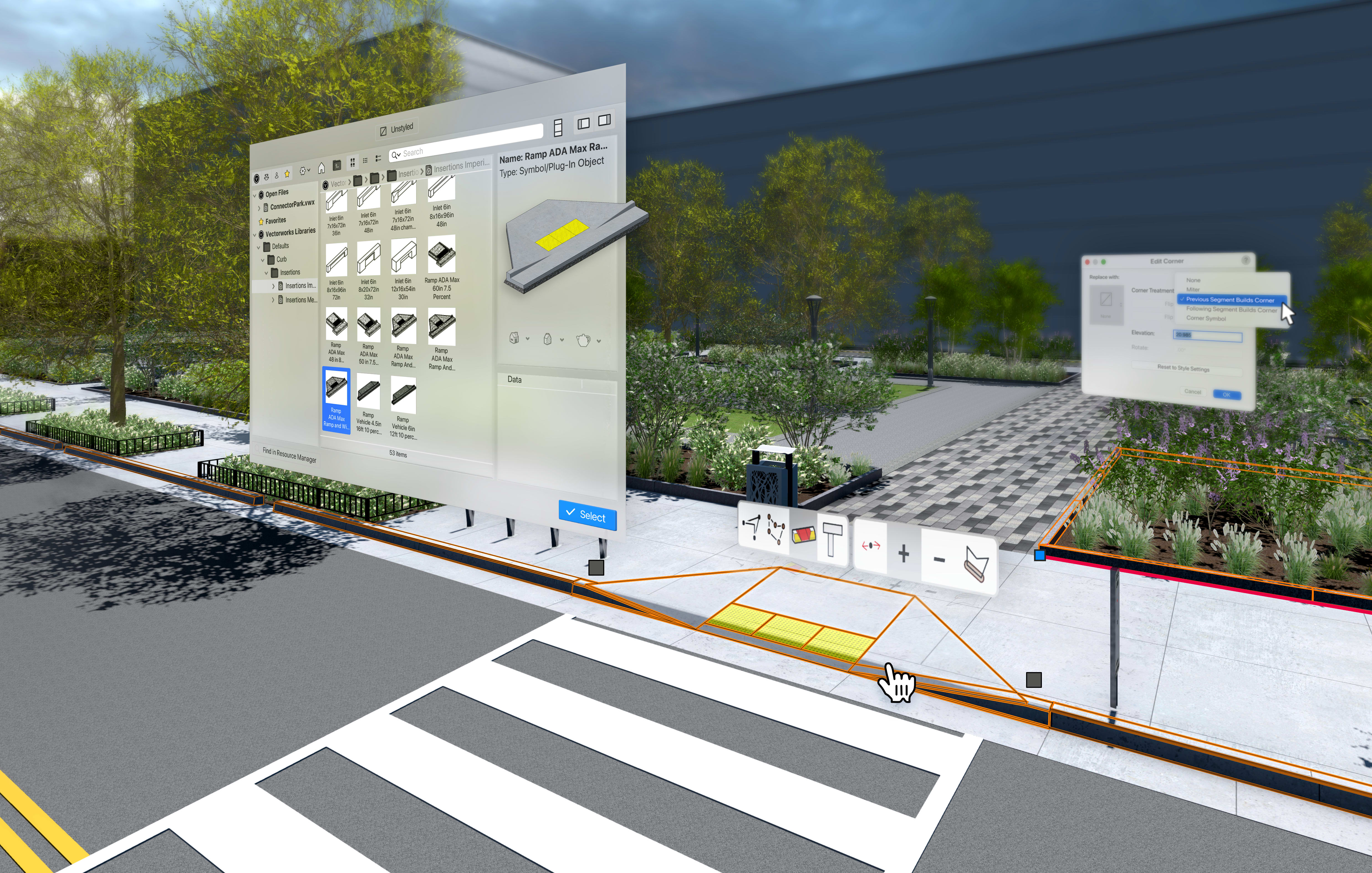
Curbs, Edging, and Borders Tool
With the Curbs, Edging, and Borders tool, you can create freestanding elements or seamlessly integrate them with landscape areas and hardscapes.
This tool makes it easy and intuitive to add border geometry. Simply select all or individual edges within landscape areas or hardscapes and choose whether you’d like the borders to be Associated or Freestanding. When in Associated mode, borders follow any reshaping of the main geometry, saving valuable time on manual adjustments.
Another standout feature is the tool’s flexibility when working with terrain. Using Gravity mode, curbs automatically align with existing terrain, saving time while maintaining accuracy. Modify each vertex’s elevation along a curb’s path or adjust the slope between points to shape the terrain exactly as needed.
The tool includes out-of-the-box options, including profiles, pavers, curb insertions, and corner treatments. You can also add your own profiles, paving units, or even design a unique pattern.
Planar Pad, Hardscape, and Landscape Area Tools
The addition of Planar Pad Site Modifiers, along with updates to the Hardscape and Landscape Area tools, enhances connectivity across Vectorworks 2025’s suite of site design tools. Additionally, both the Hardscape and Landscape Area tools now offer a single location for assigning graphics through the Attributes Pane.
Efficient Grading with Planar Pad Site Modifiers
Planar Pad Site Modifiers simplify grading by giving you a more intuitive approach to adding and editing slopes. You can control slopes by adjusting start and end elevations or inputting a precise slope. Built-in annotations automatically label slopes, reducing time spent on manual spot elevations.
Sustainable Design Data Integration
New data fields in hardscapes and landscape areas bring sustainability to the forefront of your design process. You can select from pre-defined standard sustainability frameworks and input specific permeability data, documenting these within annotations and reports to meet regulatory and design goals.

The Survey Point Tool
The Survey Point tool, part of the GIS toolset, provides a convenient way to align your projects with a known point in the real world. Enter coordinates in either latitude and longitude or easting and northing and set secondary coordinates or project elevation to define the project datum for exporting to IFC. This easy-to-use feature is excellent for ensuring compatibility with various coordinate systems, enhancing your collaborative workflows.
Aligning the survey point with the Internal Origin or existing grid intersections simplifies BIM project setup and model federation. Notifications alert you when a Survey Point is placed far from the Internal Origin, prompting you to make adjustments for project performance.
The tool also lets you customize the 2D and 3D graphics of your survey and reference points via the Preferences menu. And adjusting a Survey Point is simple — use the Unlock button in the Object Info palette to make instant updates to your Survey Point’s coordinates, alignment, or graphics.

Stay in the know with the latest insights
Subscribers receive news, customer stories, success and learning tips, event information, and other important announcements form Vectorworks.
By submitting this form, you agree that Vectorworks, Inc. and its authorized partners may contact you in regards to news, offers, and the use of our software, services, and platforms. Learn more about our privacy practices and your data on our privacy page.*