Every design project needs a strong foundation, and for landscape designers and architects, that foundation begins with establishing a comprehensive base plan. This initial step is crucial, serving as the cornerstone upon which the entire design process is built.
Fortunately, with Vectorworks, you have the flexibility to start your projects in a way that best suits your workflow, ensuring that your base information remains useful throughout the design process. Whether you’re importing background files, using advanced Geographic Information System [GIS] data, or integrating 3D models, Vectorworks offers a range of tools to make the often-tedious task of creating a base plan both intuitive and efficient.
What Is a Base Plan?
A base plan is the foundation from which site designers or architects build their models. It contains pertinent site information that’s necessary to inform the rest of the design process, and often includes geolocation to tie the project to a real-world location.
Workflow Flexibility: Tailoring Your Base Plan Setup
One of the standout features of Vectorworks is its flexibility. This is particularly beneficial during the pre-design phase, where setting up the base plan is often the first task. Whether you’re working off a surveyor’s site plan, incorporating field measurements, or referencing regularly updated site information, Vectorworks can accommodate your needs.
For those accustomed to importing “background” files, Vectorworks supports a wide range of formats, including DWG, PDF, RVT, and image files. This means that regardless of how your initial gathered site data is presented, you can easily bring it into your project. Even if you’re not using another professional’s plan, you can still streamline your process by leveraging the field measurements you’ve captured yourself.
Multimedia Support: Importing and Referencing Files
One of the common challenges in site design is dealing with different file formats. Vectorworks simplifies this by offering robust multi-media support, enabling you to import and reference files from various sources.
DWG Files: If you’re working off a survey or site plan generated by a surveyor or civil engineer, importing DWG files is straightforward in Vectorworks. This is particularly helpful for firms that need to integrate precise measurements and site details including georeferencing into their base plan. For projects that require regular updates to the plot or site plan, DWG referencing ensures that these updates are incorporated smoothly.
PDF Files: In cases where the survey data is in PDF format, Vectorworks allows you to view and snap to the geometry in vector-based PDF files. This snapping feature is particularly useful if you need to trace the drawing to reduce file size by removing unnecessary source data while maintaining accuracy. For projects that require regular updates to the plot or site plan, PDF referencing ensures that these updates are incorporated smoothly.
Image Files: For designers who prefer to start with hand-drawn sketches or work created in other design software like Adobe Illustrator or Morpholio Trace, Vectorworks allows you to import these images directly. This feature is especially useful if you hand draw your inventory using field measurements, allowing you to easily integrate your sketches into the digital workflow.
RVT Files: There’s a good chance that you’ll be asked to work off a RVT project model. Referencing will support your collaboration needs even if you expect the RVT model to change. If IFC is the preferred BIM collaboration format, Vectorworks can work with that as well.

Incorporating 3D Geometry: Enhancing Your Base Plan
In modern landscape design, integrating 3D geometry into your base plan is becoming increasingly important. Whether your project began in Rhino, SketchUp, or another BIM application, Vectorworks allows you to import these 3D models directly into your project. This capability means that your landscape designs can coexist with existing 3D structures and surfaces, providing a more complete context for your work.
By importing these models, you can quickly switch between 2D plan views and 3D elevation views, making it easier to visualize the outcome. This feature is particularly beneficial when creating hybrid landscapes, as it allows you to see how the proposed landscape will interact with the surrounding built environment.

3D model courtesy of Surface 678.
Leveraging Advanced Technology: GIS and Drone Data
To further enhance the accuracy and detail of your base plan, Vectorworks integrates advanced technologies like GIS data and drone captures.
GIS Data: By importing GIS data, such as shapefiles (SHP) or feature services, you can incorporate existing geographic information into your base plan. This can include parcel data, building footprints, pavement, soils, vegetation, and topography. Using GIS data ensures that your design is grounded in accurate, real-world information, saving time and reducing the risk of errors.
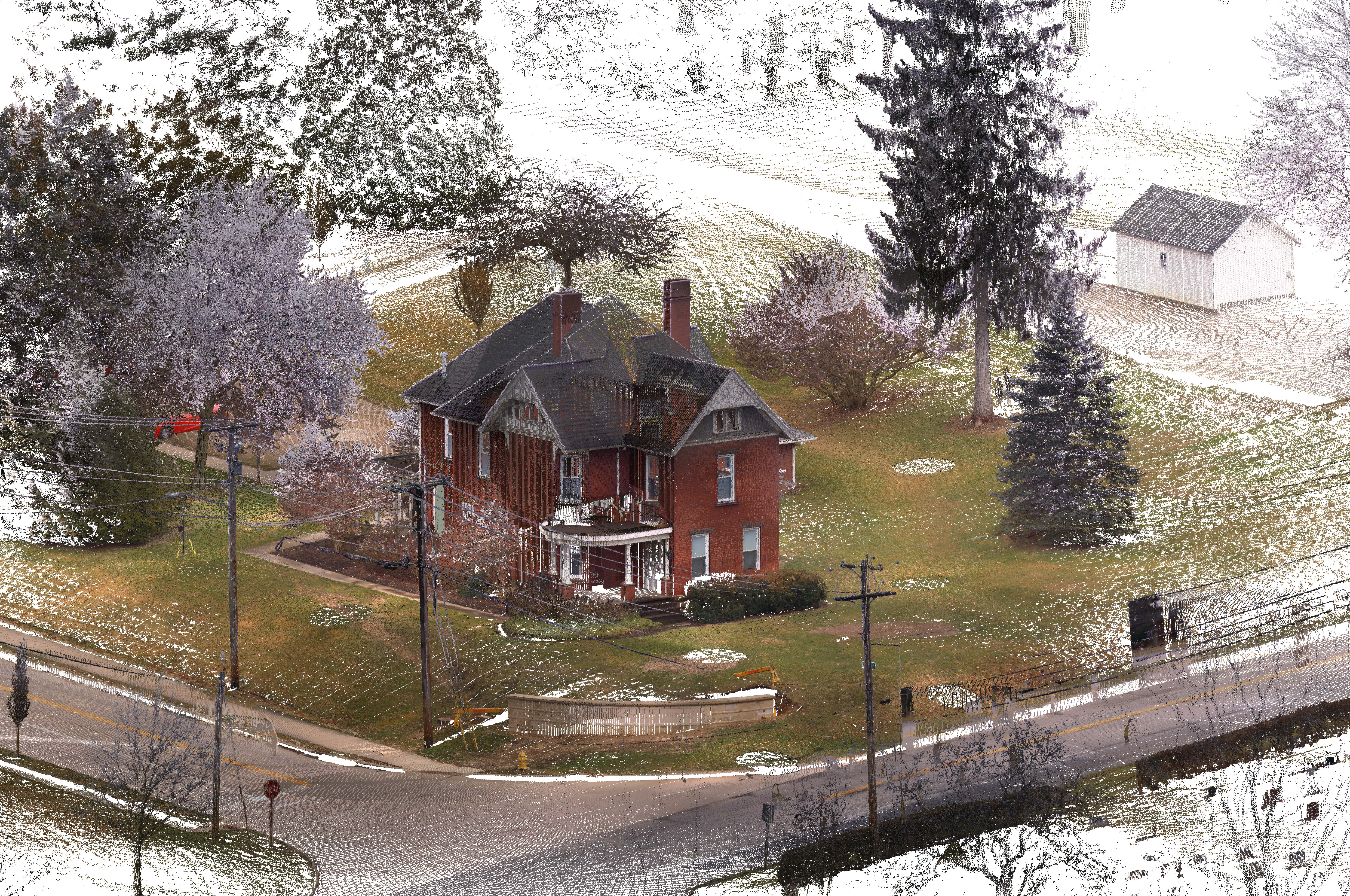
Drone and Survey Device Captures: With the rise of drone surveys and DIY drone captures, designers can now gather more detailed site information in less time. Vectorworks supports the import of images converted into mesh models or point clouds, which can be used to generate detailed context for your base plan. This data can remain in the file for regular reference or be transformed into a hybrid base plan or model.
Hand-held Devices and Photogrammetry: With the advent of lidar-capable mobile devices and apps like Nomad, you can capture site data using your phone or tablet. This data can then be directly integrated into Vectorworks, allowing you to quickly establish a base plan without needing additional equipment or software.


Thorne House survey and point cloud (left). Site surveying equipment (right).
Stay in the know with the latest insights
Subscribers receive news, customer stories, success and learning tips, event information, and other important announcements form Vectorworks.
By submitting this form, you agree that Vectorworks, Inc. and its authorized partners may contact you in regards to news, offers, and the use of our software, services, and platforms. Learn more about our privacy practices and your data on our privacy page.*