Using separate software for drafting, modeling, and data management in your landscape design process increases the risk of inconsistencies and requires constant and time-consuming revisions. Unlike traditional 2D landscape design software, Vectorworks Landmark integrates these functions within a single platform, so updates to your 2D drawings and 3D models remain synchronized across multiple views. This reduces manual corrections and helps maintain design accuracy throughout your workflow.
Work Smarter with a Unified 2D and 3D Environment
In Vectorworks Landmark, 2D landscape design and 3D modeling are integrated into a hybrid environment. When you modify a hardscape boundary or adjust a site model’s elevations, these changes update across related design elements while still allowing for precise refinements.
2D/3D hybrid objects further streamline your workflow by linking graphical representations with embedded data. For example, increasing the height of a retaining wall can automatically adjust grading calculations and adjacent hardscapes as long as the correct site modifiers are applied.
Site and Terrain Modeling
Grading and terrain modeling shape a site by modifying elevations and defining surface conditions. In Vectorworks Landmark, grading objects and site modifiers let you adjust terrain in real time, reducing manual recalculations and maintaining grading continuity across site elements. These tools help manage slopes, drainage, and cut-and-fill adjustments without the need to redraw contours manually.
Terrain models support informed site grading by helping you simulate elevation changes, assess slope stability, and refine topography to meet project requirements. By incorporating accurate elevation data, you can plan for drainage, accessibility, and structural considerations while maintaining a balanced grading design.
Hardscape and Landscape Area Tools
Terrain conditions often dictate whether your proposed landscape adapts with grade-adhering softscapes or slope-modifying hardscapes. Vectorworks Landmark provides tools for hardscapes, patios, pathways, and retaining walls that respond to site conditions.
These elements adjust with your design input, allowing you to define parameters such as slope adjustment and material transitions to ensure site compatibility.
Landscape areas in Vectorworks Landmark are softscapes that include real-world data parameters, such as:
- Plant distribution by rate or percentage
- Mono- or multi-species planting
- Mulch depth
- Soil composition
These attributes provide data for accurate reports and documentation, such as material takeoffs, cost estimation, and specifications.

Hardscape Object Settings in Vectorworks Landmark.
Integrated Data Management
Vectorworks Landmark reduces manual data entry by linking worksheets directly to the design model. This integration enables bidirectional editing, so updates made in worksheets—such as plant schedules or irrigation data—automatically sync with the corresponding elements in the drawing.
Worksheets also support sustainability tracking, allowing you to document water usage, material sourcing, and environmental impact factors. This data helps with regulatory compliance by providing detailed records for reporting and analysis.
Automated Material Calculations
Manually tracking material quantities can lead to errors, especially in large projects. Vectorworks Landmark uses calculations that update as the design changes, reducing the need for manual adjustments.
- Smart Objects: Hardscapes, landscape areas, and site models can dynamically calculate volumes, surface areas, and excavation needs when modifications are applied.
- Worksheets: Linked data tables update instantly, reflecting modifications to material properties like pavement thickness or plant density.
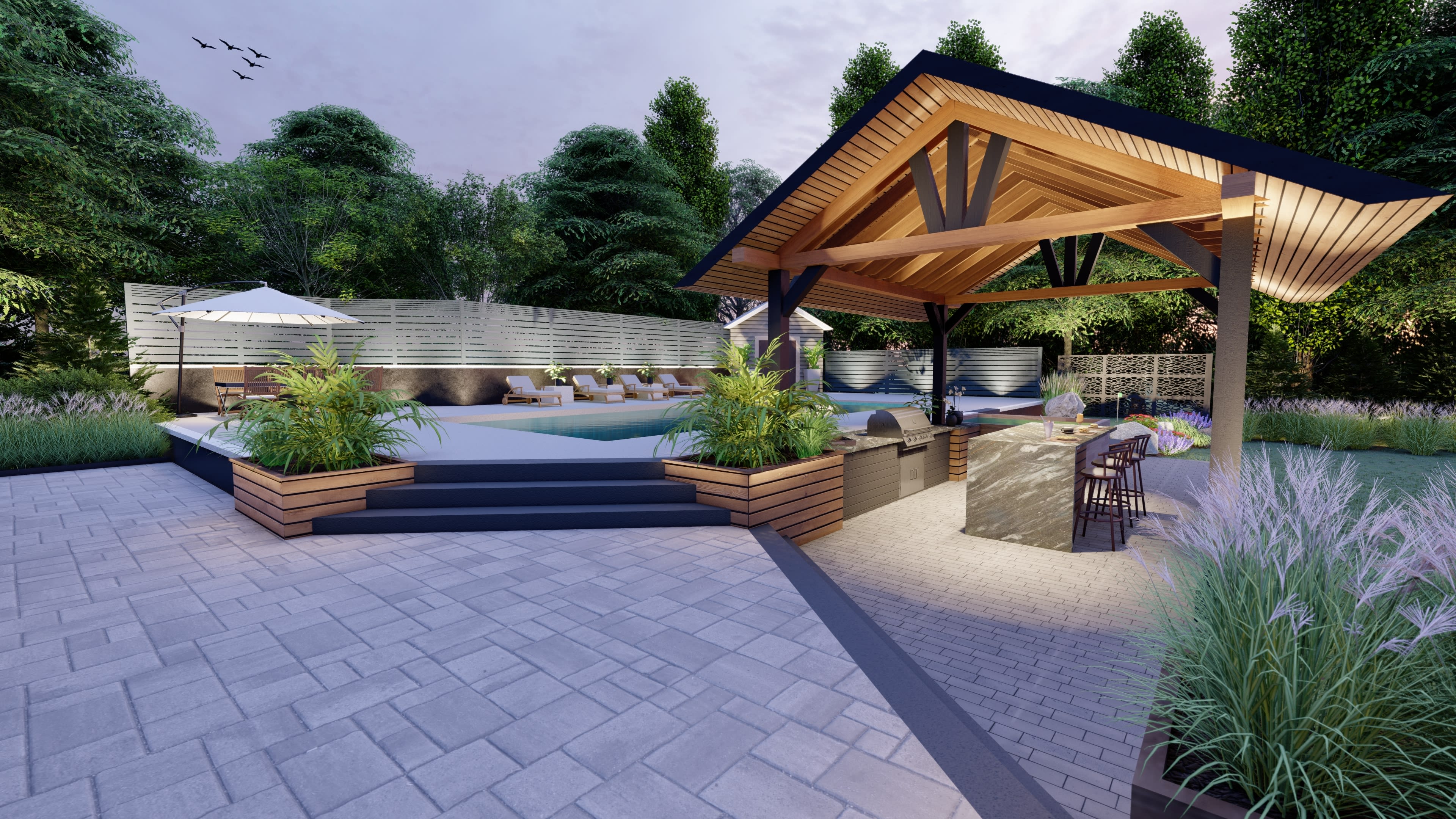
Photorealistic Rendering with Renderworks
Landscape design goes beyond technical drawings—it also tells a story. Renderworks, Vectorworks’ suite of integrated rendering tools, offers physically based rendering (PBR) and artistic visualization tools for compelling presentations.
With Renderworks, you can:
- Simulate time-of-day and seasonal lighting changes
- Render realistic material properties, including reflections, transparency, and texture mapping
- Apply artistic rendering styles, such as sketch and watercolor, for conceptual presentations
Because all of these tools are available in Vectorworks Landmark, designers can create high-quality visuals without needing external software. This keeps presentations, stakeholder approvals, and site analyses simple and efficient.
GIS and Geospatial Data Integration
Real-world accuracy matters in landscape architecture. Vectorworks Landmark integrates GIS data to support mapping, environmental analysis, and regulatory compliance.
GIS applications include:
- Plan stormwater management strategies
- Analyze environmental impact data
- Coordinate with engineers, city planners, and regulatory agencies
GIS provides the spatial context you need to refine terrain and verify compliance with regulations. This keeps designs aligned with site conditions while allowing for project-specific adjustments.

Images courtesy of RaeburnFarquharBowen.
Compatibility with Other Software
Seamless collaboration requires smooth file exchange across different platforms. Vectorworks Landmark supports open industry standards, making it easy to share data with BIM and CAD software (IFC, DWG, DXF, RVT), 3D modeling applications (SketchUp, Rhino), and GIS tools (Shapefiles, GeoTIFF). With broad file format compatibility, teams can work together without data loss or lengthy conversions.
Unifying 2D Landscapes and 3D Models
In contrast to traditional 2D landscape design software, Vectorworks Landmark brings together 2D drafting, 3D modeling, GIS data, and automated calculations, keeping everything connected and up to date.
With linked data tables, real-time model updates, and broad file compatibility, designers can work more efficiently and avoid the manual work that slows down projects. Whether adjusting terrain models, generating material takeoffs, or creating realistic renderings, everything stays in sync, reducing the need for constant revisions.
Work faster, maintain accuracy, and keep projects aligned with design requirements using a fully integrated 2D and 3D landscape design solution.
Featured image courtesy of Rembrandt Landscapes.
Stay in the know with the latest insights
Subscribers receive news, customer stories, success and learning tips, event information, and other important announcements form Vectorworks.
By submitting this form, you agree that Vectorworks, Inc. and its authorized partners may contact you in regards to news, offers, and the use of our software, services, and platforms. Learn more about our privacy practices and your data on our privacy page.*