
Site analysis is a preliminary process in architecture, landscape design, and urban planning. It involves a detailed examination and assessment of a site before designing a project.
Through this process, professionals gather critical data about the site’s physical, environmental, and cultural characteristics. This information helps guide design decisions that optimize both functionality and aesthetics while contributing to the project’s alignment with local regulations, environmental constraints, and community needs.
Continue reading to learn more about the fundamentals of site analysis, how to analyze site conditions, and why it’s so important for architecture and landscape design projects.
Why Site Analysis Is Important
Effective site analysis serves as the foundation for successful projects in site design. Here are several reasons why it’s essential:
Informed Decision Making: Understanding a site’s topography, climate, soil conditions, and surroundings allows you to make well-informed choices about the project’s layout, materials, sustainability practices, and more.
Environmental Considerations: Site analysis helps identify environmental constraints such as flood zones, erosion risks, or protected natural resources. Biodiversity Net Gain (BNG) assessments allow designers to inventory and document a site's biodiversity, establishing a baseline upon which to improve. These factors must be considered to create environmentally responsible designs that minimize negative impacts.
Legal and Regulatory Compliance: It’s important to consider local zoning laws, building codes, and other regulations that may influence what’s feasible on a site. An effective site analysis helps prepare the design to adhere to these rules.
Community Integration: Understanding the social and cultural context of a site helps to create projects that harmonize with the local community. With public projects, this likely would include in-person input-gathering, since those from the community have the best understanding of how the site is used and could be used.
Cost-Effectiveness: Identifying potential site challenges early in the process, such as difficult terrain or existing infrastructure issues, can help manage project costs by allowing for strategic planning to avoid expensive surprises later.

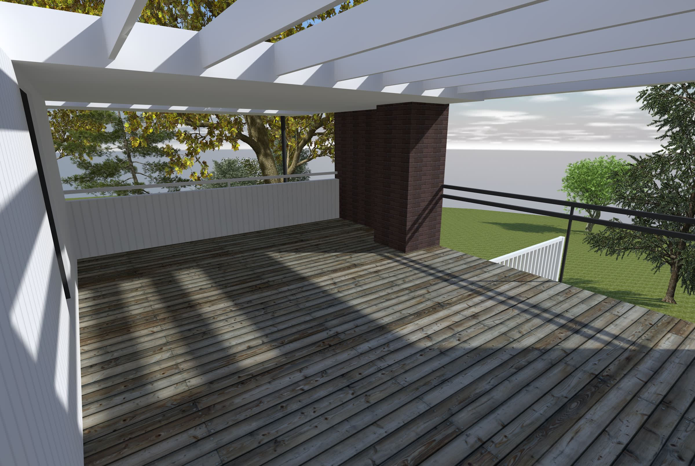
Images from landscape architecture projects showing sites’ elevations, slopes, and contextual aerial imagery, from top to bottom.
Important Elements of Site Analysis
Naturally, there’s a lot to consider when you’re conducting a site analysis to understand site conditions. The kind of information you set out to gather can depend on your goals for the project. Consider gathering information about the following categories:
Topography: Understanding the land’s slope, elevation, and features is essential for determining the best placement for structures and other site elements. Sites with steep slopes, for instance, may require retaining walls or specific foundation techniques to ensure stability.
Climate: Site analysis involves examining local weather patterns, including wind direction, rainfall, and sunlight exposure. These factors inform decisions on building orientation, materials, and passive heating or cooling techniques.
Soil and Geology: The type of soil present at a site can impact everything from foundation design to water drainage.
Hydrology: Understanding water movement on and around a site is critical for addressing potential drainage issues, preventing flooding, and integrating water management systems, such as stormwater retention.
Vegetation and Wildlife: Site analysis should account for natural ecosystems. This involves identifying existing plant species, animal habitats, and protected areas, allowing the design to incorporate these elements or work around them sensitively.
Accessibility and Circulation: How people and vehicles will move to, through, and from the site is crucial. Consider access roads, pedestrian paths, parking, and transportation links so the site is well connected and functional.
Surrounding Context: Understanding the attributes and challenges of the surrounding area, including existing buildings, infrastructure, and cultural or historical landmarks, can help the new design integrate with its environment.

A site model in Vectorworks Landmark showing a site’s existing contours via data visualization. Project by PWP Landscape Architecture.
How to Analyze Site Conditions
Conducting a thorough site analysis typically includes the following steps.
Site Visit
The first step in any site analysis is visiting the site. You’d walk the site to observe firsthand its physical features, vegetation, existing structures, and surrounding areas. Taking photos, measurements, and notes is essential at this stage.
Data Collection
After the initial site visit, you’ll want to gather more information. This may involve topographical surveys, soil testing, and consultations with environmental experts or engineers to understand hydrology, geology, and other site conditions.
Zoning, Legal, and Contextual Research
Before proceeding with design concepts, it’s vital to research local zoning laws, building codes, and any other legal restrictions that could impact the project. This will help identify what’s allowed on the site. Additionally, understanding the broader social, cultural, and historical context of the site is important for helping the design fits within and amplify its surroundings.
Climate Analysis
Using climate data tools and local weather records, you should analyze sunlight patterns, wind directions, rainfall, and temperature fluctuations to optimize the project’s orientation and material choices.
Synthesis of Data
After gathering information, next is to synthesize the data. This involves mapping out the opportunities and constraints of the site and using these findings to inform the design process. Using a design software allows you to create a base plan, a valuable starting schematic into which you infuse findings from site analysis.

A base plan for a residential project created in Vectorworks Landmark.
Sustainable Site Analysis Practices
One key aspect of sustainable site design is the identification and management of plant life within a project. Favoring native plants, for example, helps ensure that the landscape is well-adapted to local conditions, reducing the need for excessive irrigation, fertilizers, and pesticides. Native species also support local biodiversity by providing habitat and food for pollinators, birds, and other wildlife. In contrast, invasive plants can disrupt ecosystems by outcompeting native species, altering soil chemistry, and consuming excessive water resources. A thorough understanding of the site’s planting arrangement allows you to mitigate these risks by selecting appropriate species and implementing strategies such as controlled planting zones or buffer areas to prevent the spread of invasives.
Beyond plant selection, sustainable site analysis also considers water management strategies. Rainwater harvesting systems, permeable paving, and bioswales can be integrated to manage stormwater efficiently, reducing runoff and preventing soil erosion. For example, analyzing the site’s natural drainage patterns can help you position rain gardens in areas that collect excess water, enhancing infiltration and supporting groundwater recharge. Similarly, assessing wind patterns and solar exposure can inform the placement of trees and structures to provide natural cooling, reduce reliance on artificial heating and cooling systems, and create more comfortable outdoor spaces.
Sustainable Site Design Example
The Plasdŵr development in Cardiff, Wales, exemplifies how sustainability legislation can shape landscape design. Guided by Schedule 3 of the Flood Water Management Act, which emphasizes treating rainfall as a valuable resource, the project integrates sustainable drainage systems (SuDS) like swales and basins to enhance water quality, reduce flood risks, and boost biodiversity. Read the full story.
BIM and Site Analysis
BIM is all about data — and this data can improve the site analysis process. A dedicated BIM process helps you more quickly understand existing site conditions so you can make more informed design decisions.
For example, BIM workflows can allow you to integrate topographic data from LiDAR scans or drone surveys, creating a detailed 3D model of the terrain, which allows you to analyze slopes, drainage patterns, and elevation changes before construction begins. Additionally, embracing a BIM process can allow you to incorporate GIS data to assess environmental factors such as flood zones, soil types, and vegetation coverage, helping you select suitable materials and planting strategies. Another key application is sun and shade analysis, where BIM software can simulate how buildings, trees, and other structures will cast shadows at different times of the day and year, informing decisions about outdoor spaces, energy efficiency, and user comfort.
To learn more about how BIM can transform your landscape architecture workflow, check out our article here.
Design Software's Role in Site Analysis
In the modern architecture and landscape design fields, software tools have revolutionized site analysis by streamlining data collection, visualization, and interpreting data.

A map of terrain identifying various landscape elements. Courtesy of Raeburn Farquhar Bowen.
Data Visualization and Mapping
Software programs like Vectorworks Landmark offer powerful tools for mapping and visualizing data collected during site analysis. Topographical information, hydrology, and even sunlight exposure data can be layered within the program, allowing you to see an integrated view of the site.
Environmental Simulations
With Vectorworks Landmark, you can conduct environmental simulations to see how different design choices will interact with the site. Sun/shade analysis, for example, allows you to see the sun’s trajectory and shadow patterns across various times of day and seasons. This helps in planning sustainable designs that maximize natural lighting and regulate temperature effectively.

A shade study completed in Vectorworks Landmark showing shade conditions at 12 p.m. and 3 p.m., respectively.
Geospatial Data Integration
Integrating geospatial data into design software has become a game-changer in site analysis. Tools like Vectorworks Landmark can import data from Geographic Information Systems [GIS] to provide precise information about the site’s physical characteristics, including elevation, vegetation cover, and nearby water sources.
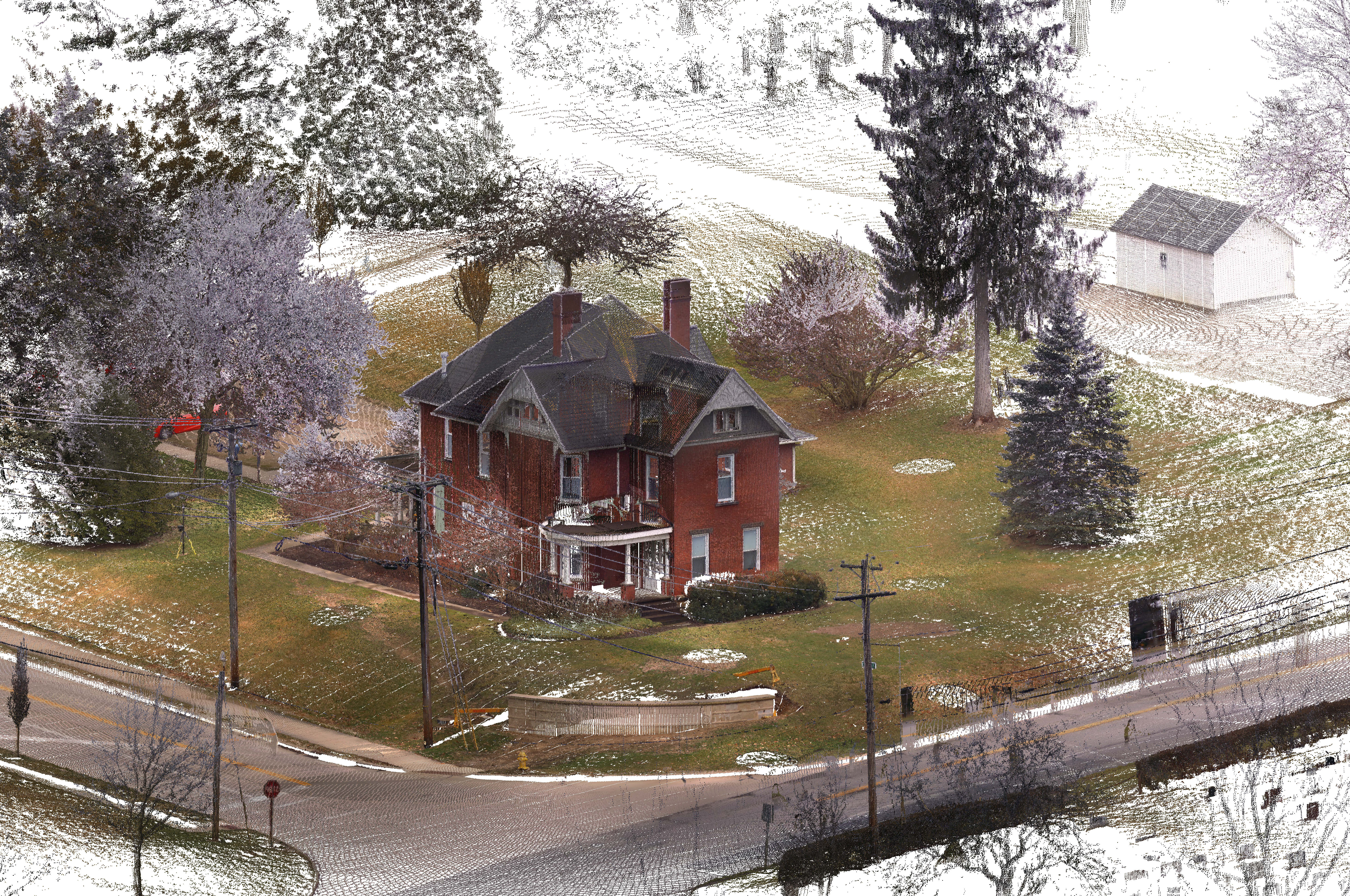
A point-cloud representation of a site imported into Vectorworks Landmark.
Collaboration and Coordination
For larger projects, site analysis often involves a multidisciplinary team, including civil engineers, environmental consultants, and architects. With cloud-based features, collaborative tools, and BIM integration, Vectorworks Landmark encourages a collaborative workflow where all project participants have access to important information at all times.
3D Modeling and Visualization
Design software allows you to build 3D models of the site’s existing conditions, helping you better understand how a project will look and function once built. This capability is especially valuable for communicating design intentions to clients and collaborators by providing an immersive, detailed view of the proposed development.

A 3D model showing 100-year flood conditions. Courtesy of McGregor + Coxall.
Efficiency and Precision in Planning
Automating certain calculations and integrating real-world data with Vectorworks Landmark helps you complete site analysis quicker and with greater precision than traditional methods allow. Automated grading, material cost estimation, and hydrological flow calculations all save time and resources, allowing you to focus on creative problem-solving.
Stay in the know with the latest insights
Subscribers receive news, customer stories, success and learning tips, event information, and other important announcements form Vectorworks.
By submitting this form, you agree that Vectorworks, Inc. and its authorized partners may contact you in regards to news, offers, and the use of our software, services, and platforms. Learn more about our privacy practices and your data on our privacy page.*